
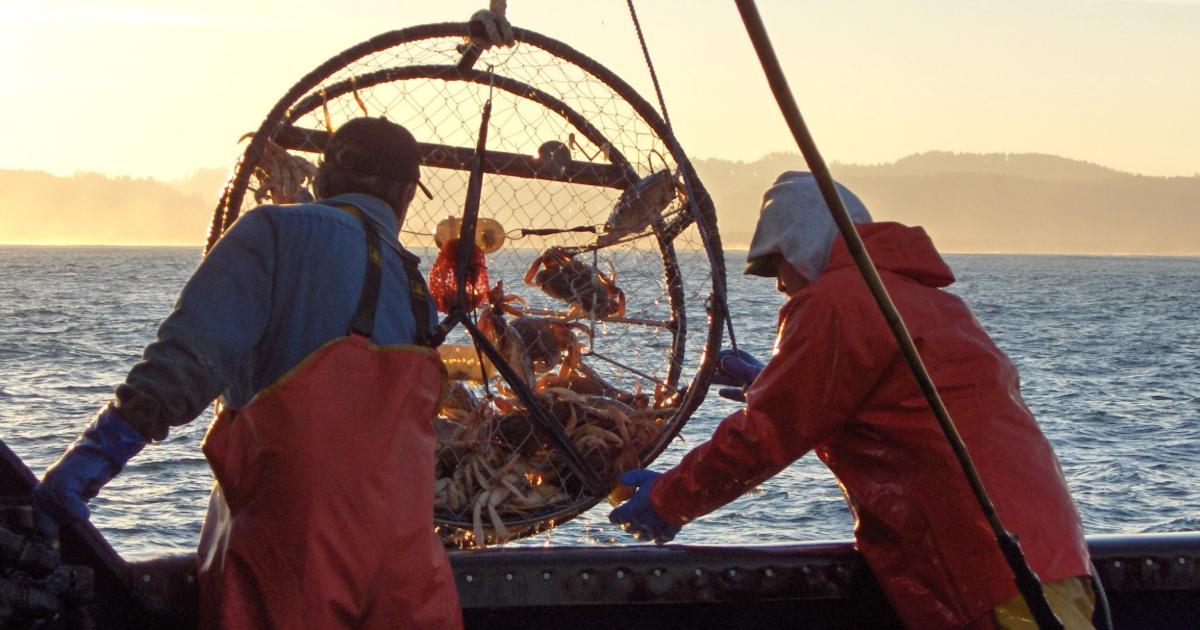
In the late 1970s, conflicts between oceangoing tugs and commercial crabbers became a major problem in Washington, Oregon and California. Crab pots fouled tugs as they moved between coastal ports, and the loss of gear created severe hardships for both commercial crabbers and towboat operators. Sea Grant programs on the West Coast helped broker an agreement that provided navigable towboat and barge lanes through the crabbing grounds between Cape Flattery, Washington, and San Francisco.
Since the late 1990s, WSG has led this process, maintaining the industries’ cooperation and saving them more than $1 million annually. WSG continues to hold two negotiations each year, improve electronic towlane charts and evaluate the project’s economic impacts.
Any questions? Please contact Jenna Keeton, 206-543-7009, keetonj@uw.edu.
Towlane updates as of March 2025
Meetings
Virtual meetings are held over Zoom on the first Friday in March. Hybrid meetings are held on the first Friday in November over Zoom and in Astoria, OR.
Current towlanes (locations last updated March 2025, summer dates last updated March 2026)
Data files
For your convenience, Washington Sea Grant has made available electronic data files for commercial crabber and towboat towlane charts.
Please note:
- The following links provide access to data files; depending on application, they will be binary (i.e., .zip) or text (i.e., .txt). You must download the appropriate file (Maptech, Nobeltec, WindPlot, etc.), decompress if it is a .zip format, and import it into the appropriate program.
- Most contemporary operating systems come with file decompression applications, enabling the downloaded file to either open automatically or open upon double-clicking it. You can also obtain a version of the program required to decompress these files online (some are free; others are fee-based).
- Before proceeding, download the data loading instructions here.
| Software | File |
| P-Sea WindPlot II | Download WindPlot file (23 Kb) |
| Rose Point Coastal Explorer | Download Rose Point file (244 Kb) |
| Nobeltec Visual Navigation Suite | Download Nobeltec file (236 Kb) |
| Maptech Offshore Navigator (2019) | Download Maptech file (35 Kb) |
| OLEX | Download OLEX file (31 Kb) |
| GLOBE | Download GLOBE file (17 Kb) |
| TimeZero Legacy Data | Download TimeZero Legacy file (28 Kb) |
| TimeZero Exchange | Download TimeZero Exchange file (25 Kb) |
| KML (2019) | Download KML file (8 Kb) |
| Towlane Shapefiles (2019) | Download Towlane Shapefiles (15 Kb) |
| Towlane Interactive Map (2021) | Download Interactive Map (1 Mb) |
List of coordinates for summer and year-round lanes
- Summer towlane coordinates (XLSX)
- Year-round towlane coordinates (XLSX)
- Advisory towlane coordinates (XLSX)
†DISCLAIMER
No Guarantees: While Washington Sea Grant has made every attempt to verify that the information provided was accurate at the time the files were created, no express guarantees are made of the information herein. No contracts, implied or otherwise, are made through providing this information. For any questions about this information, please contact Jenna Keeton, keetonj@uw.edu or 206.543.7009.
Use At Own Risk: Use this material at your own risk. Washington Sea Grant is not responsible for the consequences arising from the use of this information. The information is provided “AS IS”, and Washington Sea Grant makes no claims regarding its quality, usefulness or accuracy.
USB thumb drives
Data files are now available on a USB thumb drive free of charge. You can also download the files directly using the links above. To obtain a USB thumb drive, please contact Jenna Keeton (206.543.7009). Please be sure to download the data loading instructions.
Contact
If you require the towlane chart data in printed form, please contact Jenna Keeton, Fisheries Specialist, 206.543.7009, keetonj@uw.edu. If you have trouble accessing the data, please contact Kayj Morrill-McClure, IT Lead, 206.685.0171, kayjmmc@uw.edu.
Meeting notes archive
2025
2024
2022
2021
2020
2015
2014
2013
Map of tug/tow boat traffic through the towlanes 2020
Created by Leslie Nguyen, UW School of Marine and Environmental Affairs, July 2022.